Goldstar Aerial Photography
AERIAL REAL ESTATE PHOTOS
Indoor and Outdoor Virtual Tours. New or From Existing Photos
More than just a pretty picture
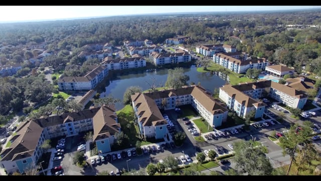
Client Commercial Realtors
Commercial Property Specialty
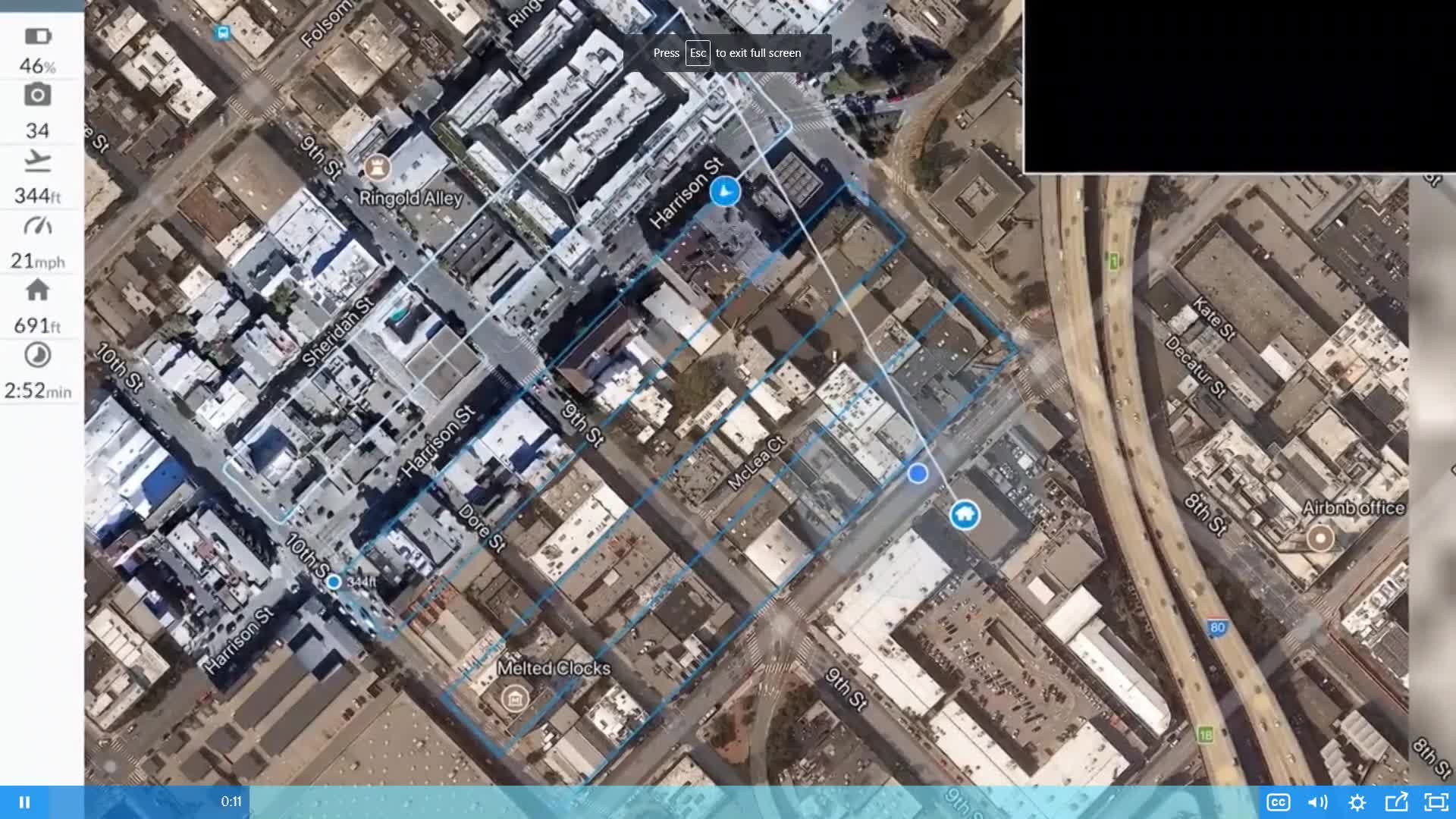
Survey-Style Ortho Maps and 3D Models
Leave It To The Experts. We Provide Licensed Photogrammetry Map Processing of Your Commercial Property. We Start By Shooting A Fresh Orthomosaic of Your Property Border in Custom, 4K Detail. A 3D Model, Plant Health Map and Online Dashboard Controls Are Included. Professional 1-Day Turnaround.
About
Professional Pilot Operation FAA Part 107 Pilot License. FAA Flight Engineer License. . . . . .
GOLDSTAR AERIAL is set to become Florida's leading aerial commercial real estate photography company. We utilize professional grade Unmanned Aerial Vehicles, not toy drones, to capture stunning aerial imagery for commercial realtors. Based in Gainesville Florida, our flight operations are committed to UAV best practices so you get great results, with less worry. Our commitment to customer satisfaction often includes a free demo of our services.
Our pricing plan is like no other. In many instances, we can provide our services for FREE until your property sells and your commission is paid.
Where licensed map & data is required for surveying purposes, Goldstar Aerial collects the data by specialized drone-software for subsequent determination and processing by licensed photogrammetrists from Drone Deploy. Surveyors are given a link to access the data online.

Real Estate
We're More Than Just a Pretty Picture